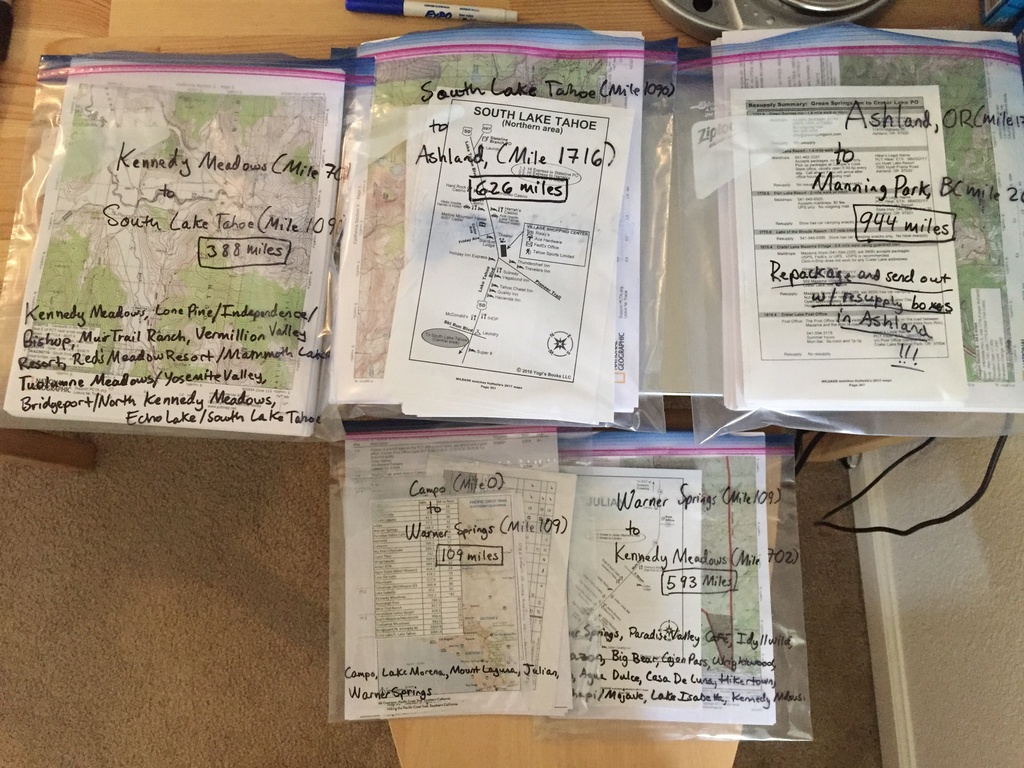
Sat Mar 18, 2017 @ 08:21


Copy the content below and paste it in the page in which you would like this embedded. Change the width value below as necessary.
Likes

When I am not working with technology, I can often be found in the backcountry; always happiest in the presence of mountains. In 2014 I successfully completed a thru-hike of the Appalachian Trail with my three kids. I ...

This member has not written a bio.

This member has not written a bio.

Fitness professional, backpacking amateur, always looking for a new challenge to get me outside my comfort zone #pct2017
Outsideways Blog
Journal Spotlight: Kayaking Around the Eye of Quebec

One of our members, will soon be circumnavigating one of the coolest lakes in Quebec by kayak
Comments
Looks like everything is coming together nicely for you! Hope all is well we miss you on IG.
@papercup yes, it's coming together, I hope it is for you as well! I might return to IG once I start hiking to just keep an eye on trail news, I've hopped on a couple of times to see how everyone is doing with prep. :)
You must login before you can comment.